Each year, around ten million children receive no vaccinations at all. More than fifty percent of these zero-dose children live in urban slums, remote communities, and conflict environments. Acasus developed a framework to help find them using geo-spatial analysis.
Acasus developed a geo-spatial dashboard to support the Federal Ministry of Health (FMoH) and Regional Health Bureaus (RHBs) of Ethiopia to identify and target zero-dose communities, based on innovative data analyses.
This enables managers to nuance health services across and within regions, based on the proximity of local populations to health facilities that provide immunisation (EPI-HFs). For example, the graphs below show the importance of prioritizing outreach activities in the Afar region,or the East Wollega Zone in the Oromia region, with 49% and 45% of the population in these areas living farther than five kilometers from the nearest EPI-HF respectively.

The dashboard also provides managers with a visual overview of probable under-served or ‘zero-dose’ communities. The view below shows the villages in Ethiopia. Those in red fall outside of the 5 km-radius of an EPI-HF.
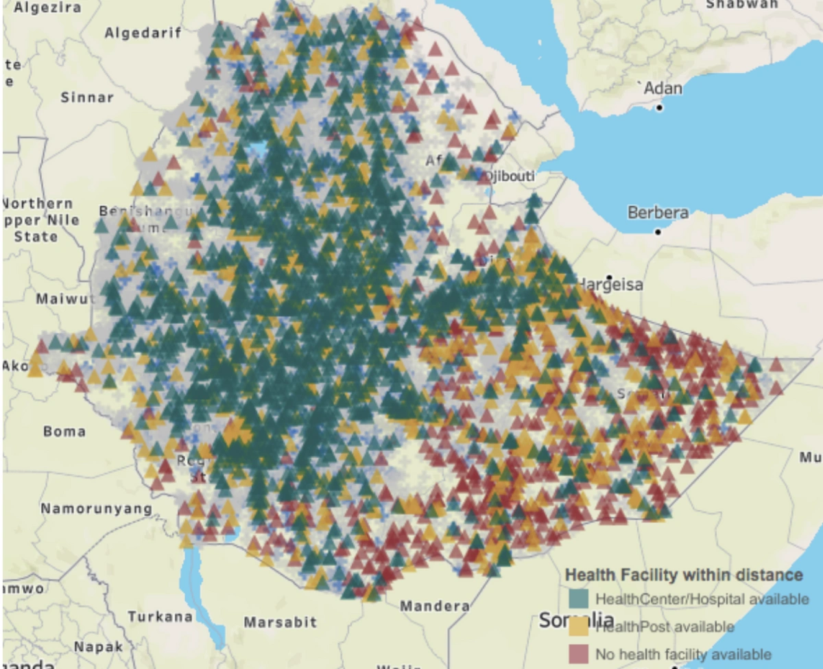
Overview of known villages in Ethiopia, based on proximity to EPI-HFs
Managers can use this tool to visualize likely ‘zero-dose’ communities. For example, the image below shows the village of ‘Getama’, which is 64 km-s away from the nearest EPI-HF and likely to be home to many ‘zero dose’ children.
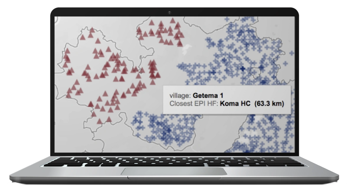
Zoom-in view of Getema village in Limu Seka Woreda, Jimma Zone in Oromia region
We are working with officials across Ethiopia to use this analysis as a part of planning activities to ensure that all children in villages like Getema receive all their required vaccinations.
A similar approach is used in Afghanistan, with geo-spatial analysis being used to revise EPI service-delivery activities to 45,000 villages across Afghanistan. Acasus developed ‘outreach information packs’ for managers, providing them with an overview of ‘outreach priority’ villages in each district, as well as the nearest EPI-HF to serve them.
Additional mapping visuals provide further clarity, showing proposed EPI-HFs to serve each ‘outreach priority’ village, as well as road networks, rivers, and topography. This also provides managers with insights on likely ‘zero-dose’ communities for each district.
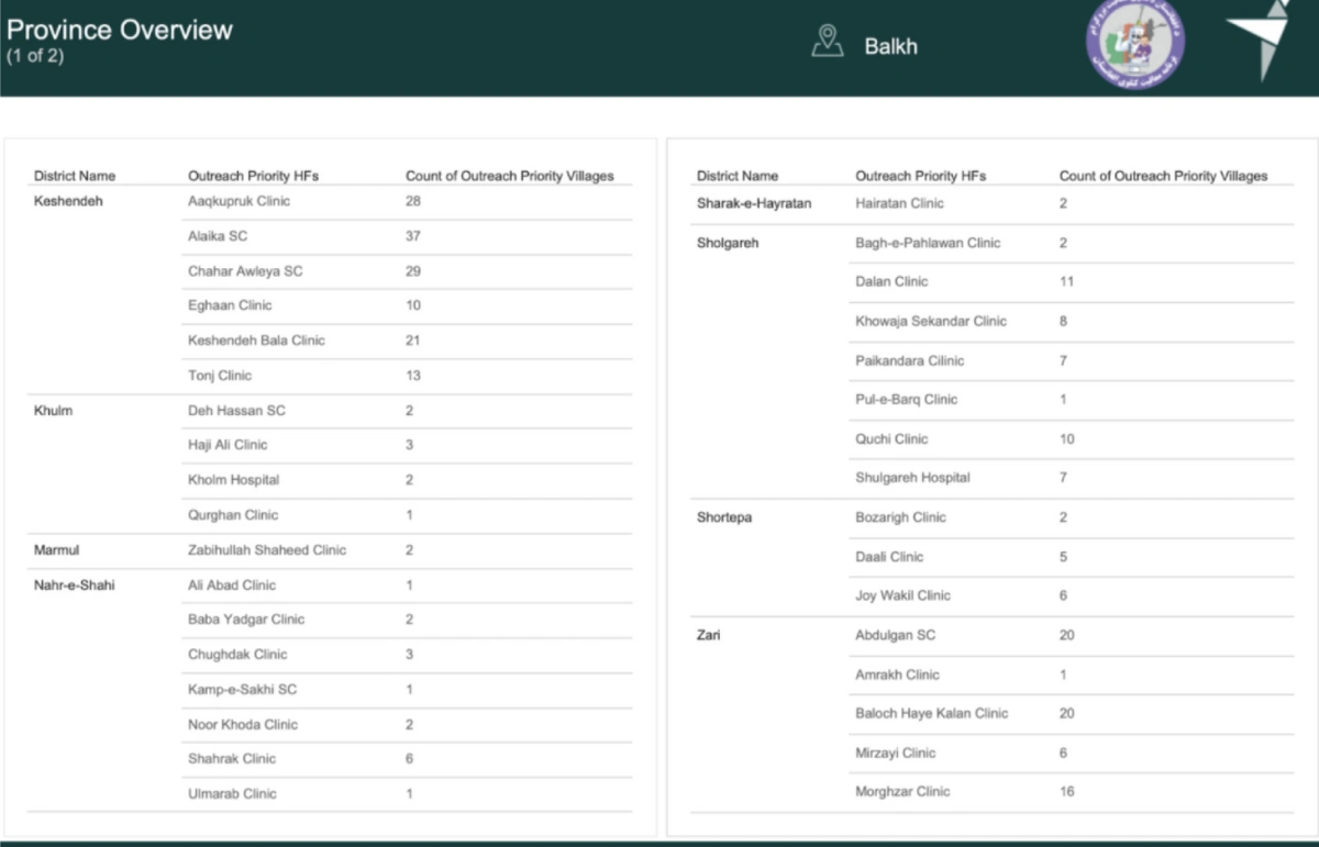
Outreach Information Pack’ overview page for Balkh province, showing the number of communities that fall more than 5km from the nearest EPI-HF in each province
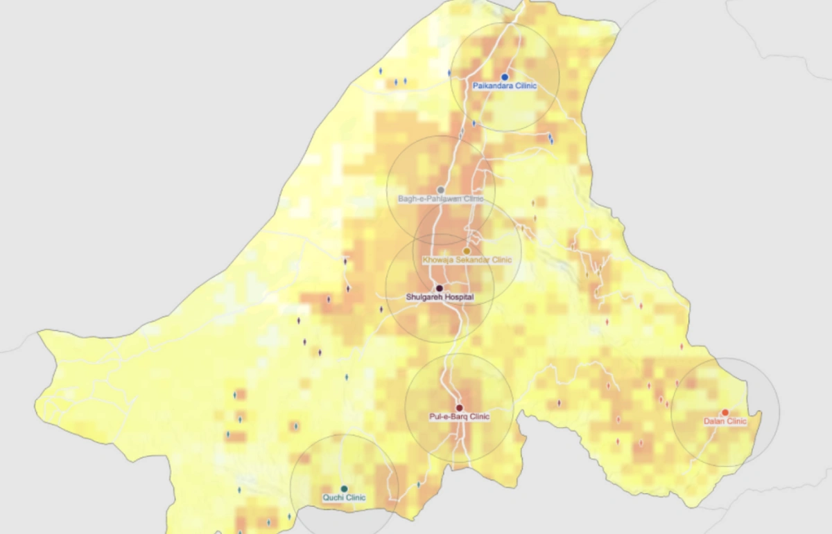
Overview of villages more than 5km from EPI-HFs, and the nearest EPI-HF to each village, in Sholgareh district, Balkh province
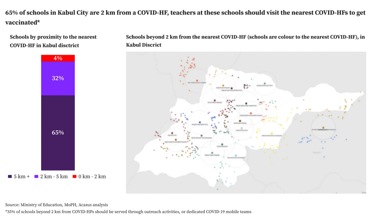
This approach is also used to inform the approach to deliver the Covid-19 vaccine in Afghanistan.
At the request of the President, Acasus leveraged geo-spatial analysis to identify and visually present the location of schools located over 2 km-s away from Covid-HFs in Kabul province. We use this analysis to plan outreach activities to vaccinate teachers from remote schools as part of new campaigns to vaccinate school teachers and university staff.
Advanced geo-spatial analysis can provide managers with simple, easy-to-use, and accurate insights to improve service delivery, target zero-dose communities and inform Covid-19 vaccination activities.